

Ancient mines
The subsoil of the island consists mainly of schist, gneiss and marble, but also is also mineral-bearing, containing argentiferous lead, copper, iron and zinc deposits, a fact that has played a catalytic role in the development of the island from prehistoric times, when exploitation of metalliferous deposits served to promote overall cultural development, being one of the main stages of transition from the Stone Age to the Bronze Age.
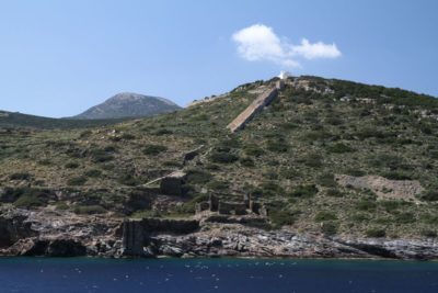
There are two arc-shaped mineral-bearing zones: One has argentiferous lead deposits and is located in the northern part of the island, stretching from the northeast to the southwest, between Agios Sostis, Agios Sylivestros, Vorini, Kapsalos and Xeroxylo. The second extends from the area of Ai Yianni at Faros to Apokofto and Aspro Pyrgo.
Evidence indicates that the first mining activities for the extraction of silver and lead took place on the peninsula of Agios Sostis at least by the beginning of the 3rd millennium BC, which makes this mine the second oldest silver mine the world.
Mining in Sifnos
(As outlined in the book ‘Sifnos: The Acropolis of Agios Andreas’ by Christina Televantou pub. Ministry of Culture)
3rd Millennium BC Exploitation of the silver mines, on the site of Agios Sostis, Agios Sylvestros (or Sylivestrou), Vorini, Kapsalos, Xeroxylos.
Archaic period (700-480 BC): Exploitation of the silver mines, on the site of Agios Sostis, Agios Sylvestros (or Sylivestrou), Vorini, Kapsalos, and Xeroxylou, and the gold mines near the location of Ai Yianni at Faros, Apokofto and Aspro Pyrgo.
19th and 20th century AD: Mining of iron ore at Agios Sostis, Agios Sylvestros (or Sylivestrou), Vorini, and Kapsalou.
Ancient acropoleis
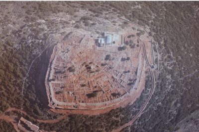
The acropolis and village of Kastro
Kastro was the old capital of the island. It has been continuously inhabited from prehistoric times (first settlements on the hill were in the 3rd millennium BC) to the present day. This is the ancient ‘city’ referred to by Herodotus, which flourished in the 6th century BC, with a Prytaneion, a large temple and a theatre dedicated to Dionysus, as well grand marble public buildings (in the ‘white agora’, the public square).


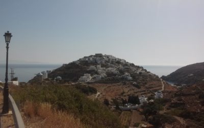
The village’s name comes from the fortress-like ‘castle’ formed by its buildings. The settlement has an ellipsoidal form, following the terrain, and has a defensive aspect, preserving unchanged its medieval (Venetian) fortified form. Two defensive rings of buildings can be observed, each built close by the next, with mansion houses for the richer inhabitants in the inner ring where they had greater protection, and the houses of the poor in the outer ring.
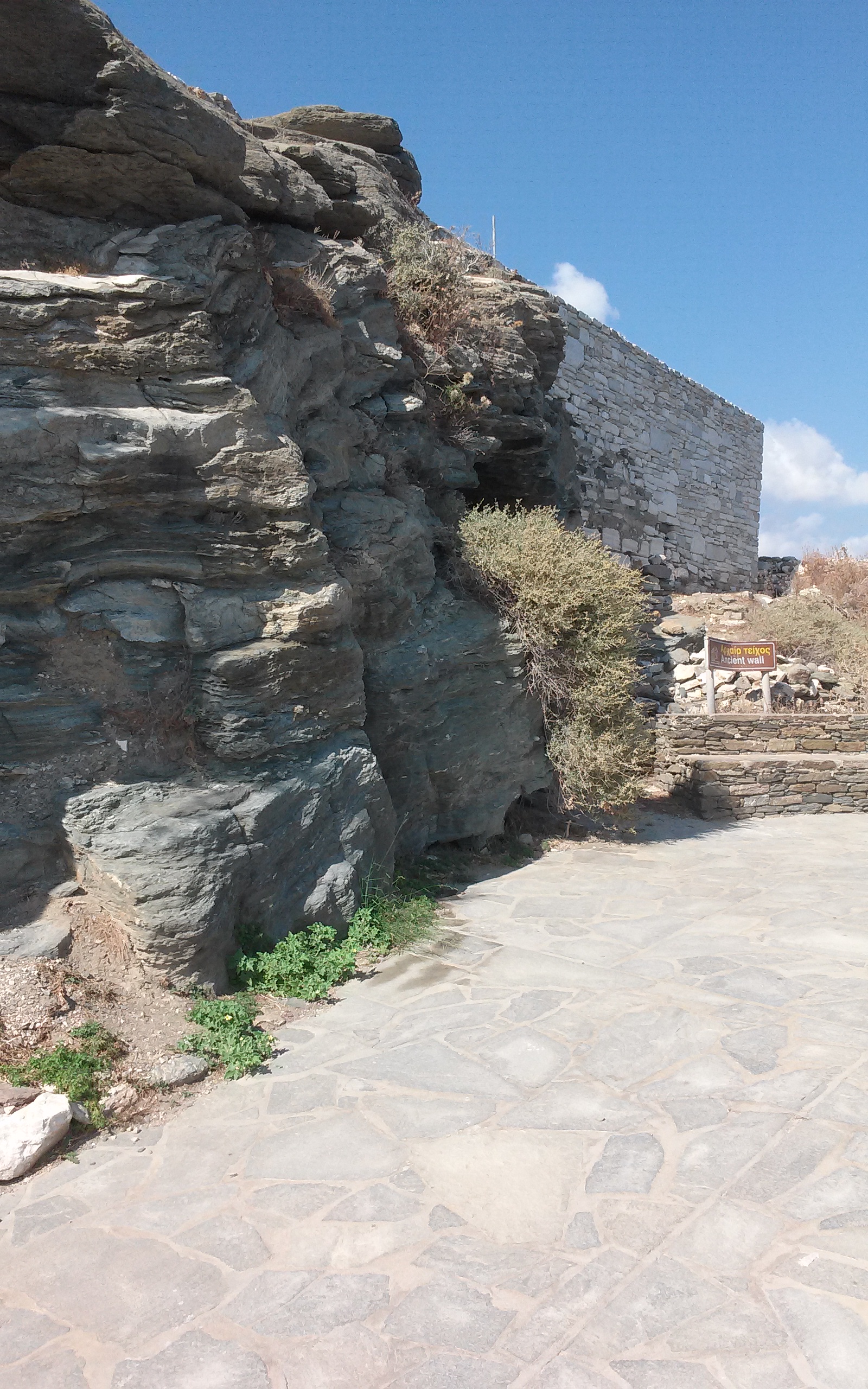
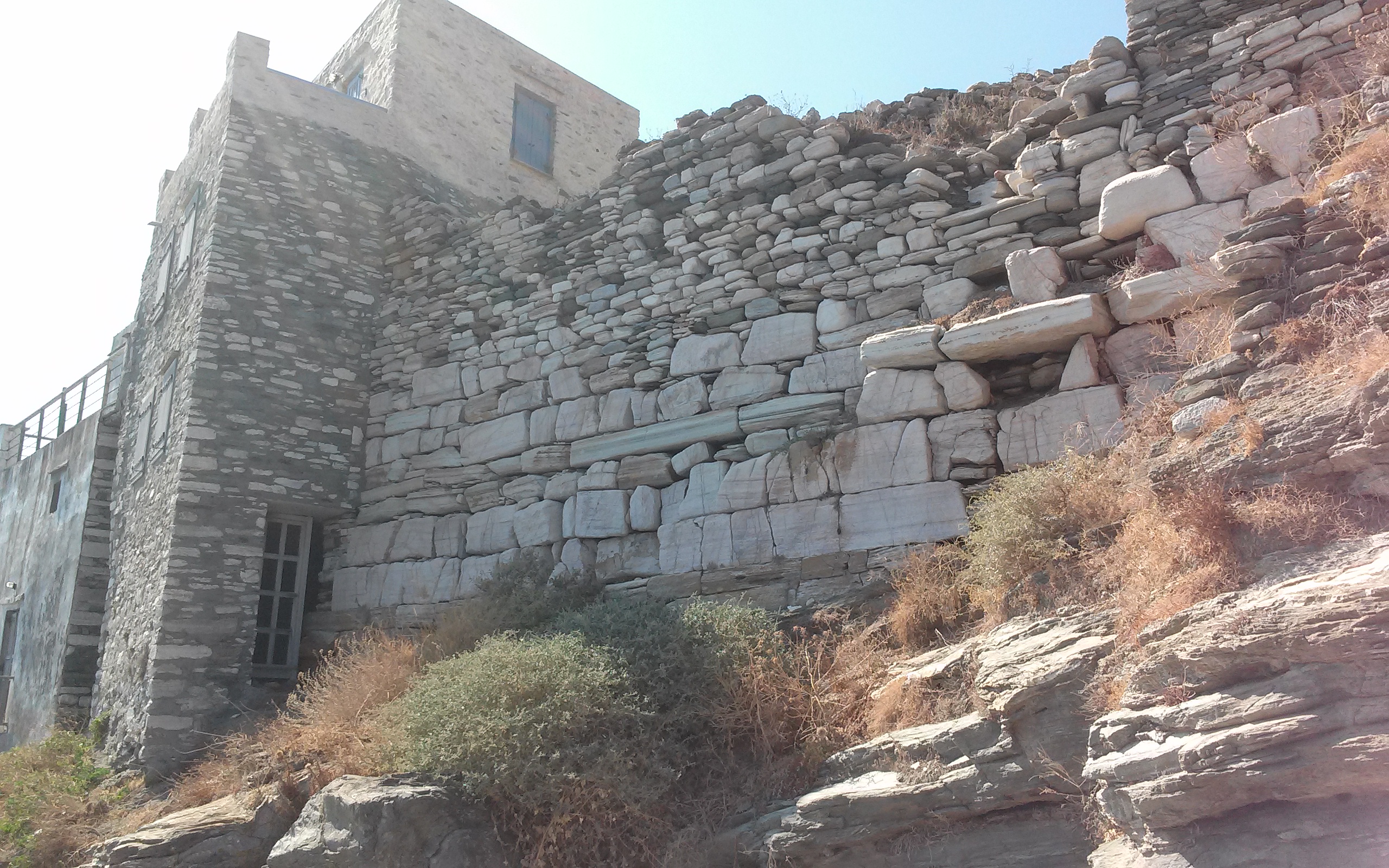
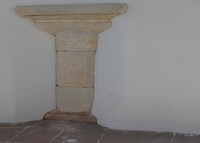
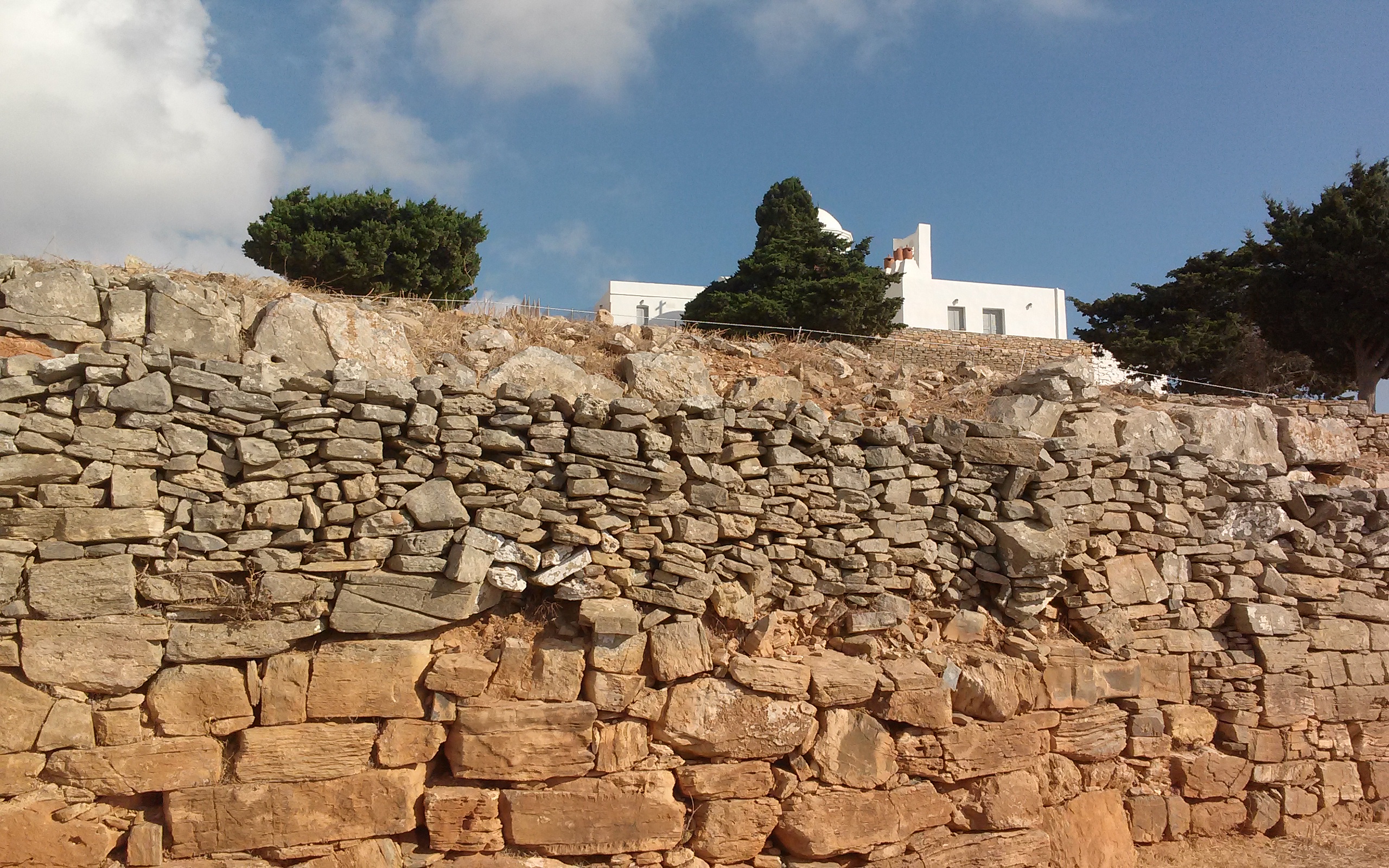
At the very top of the hill are the ruins of the ancient acropolis of Kastro (6th century BC), with a Sifnian marble wall, the only surviving marble wall of this era in the Cyclades preserved today.
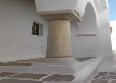
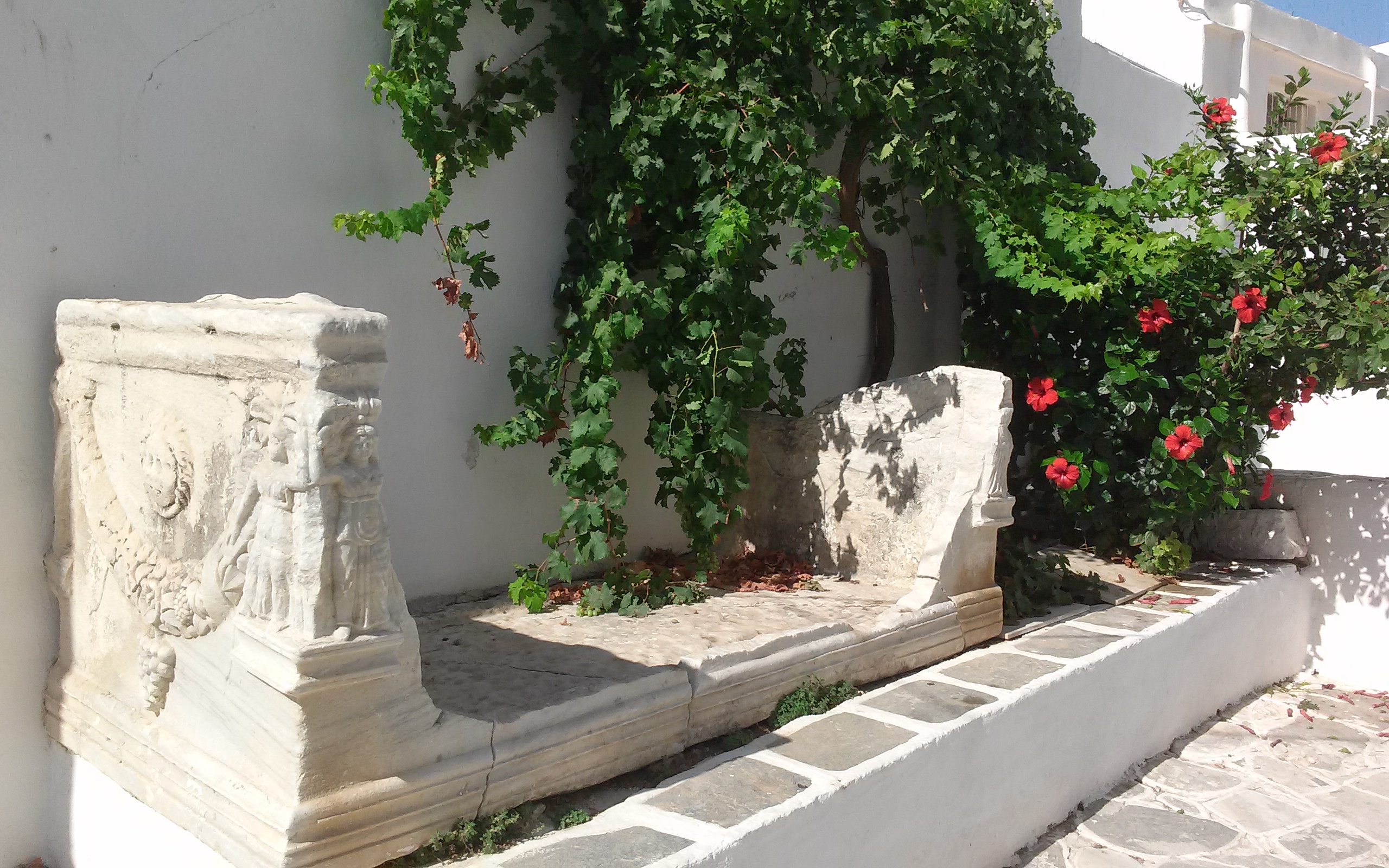
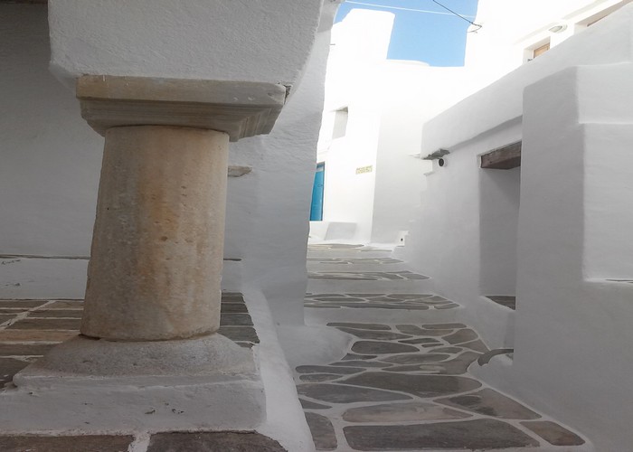
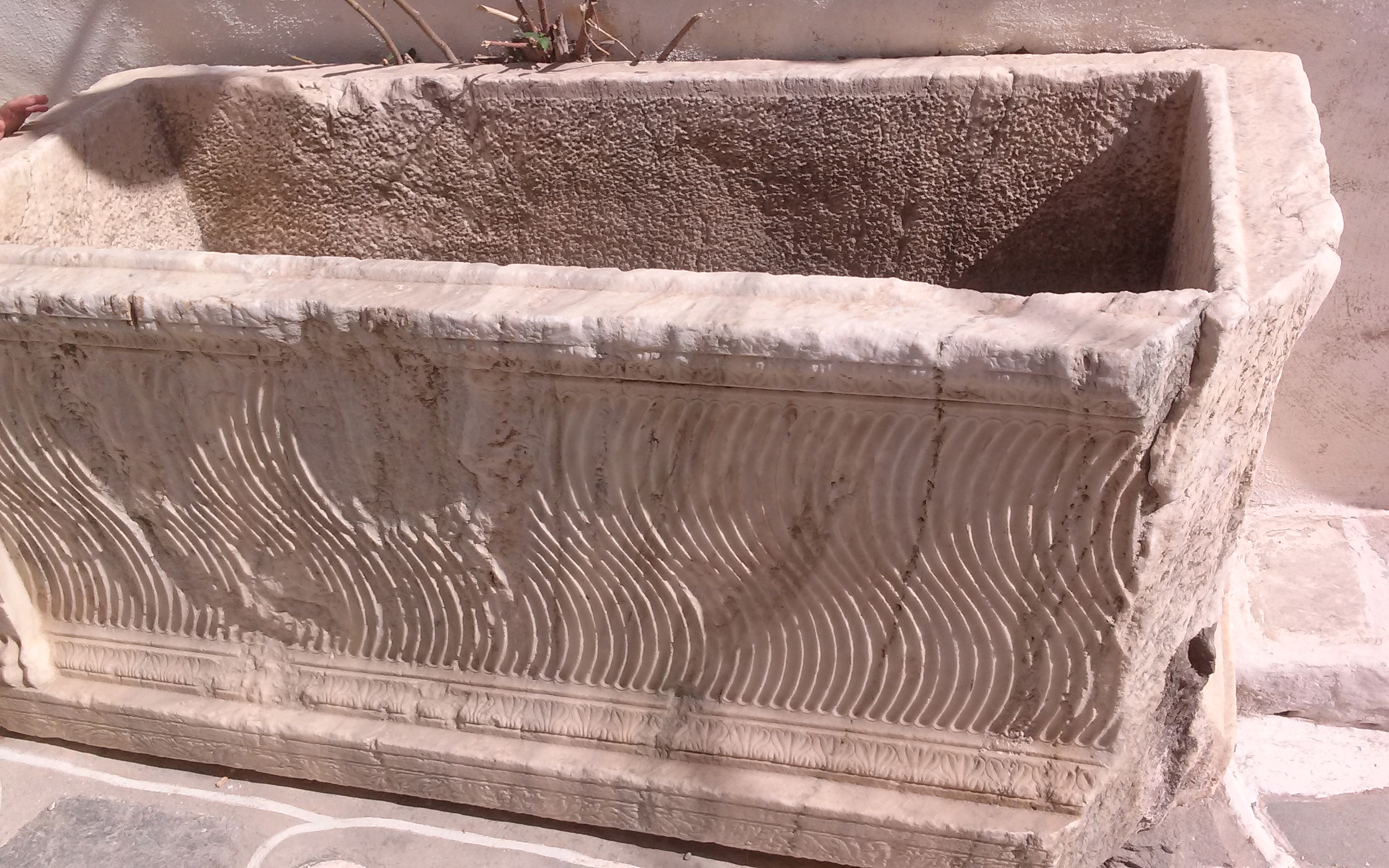
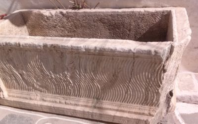
The ancient acropolis, the ancient columns set in the walls of newer buildings, the Roman sarcophagi to be seen in the alleys, the six ‘lodges’ (gateways at the entrances to the village), 16th and 17th century chapels with decorated floors make Kastro a living open-air museum.
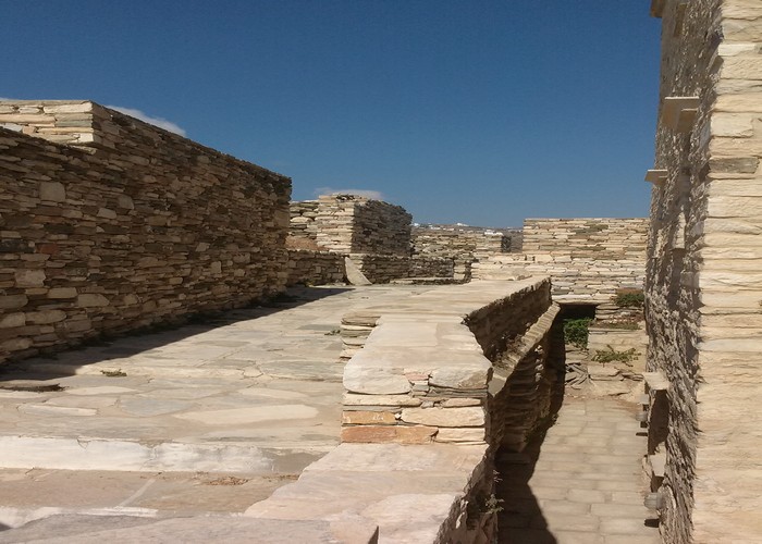
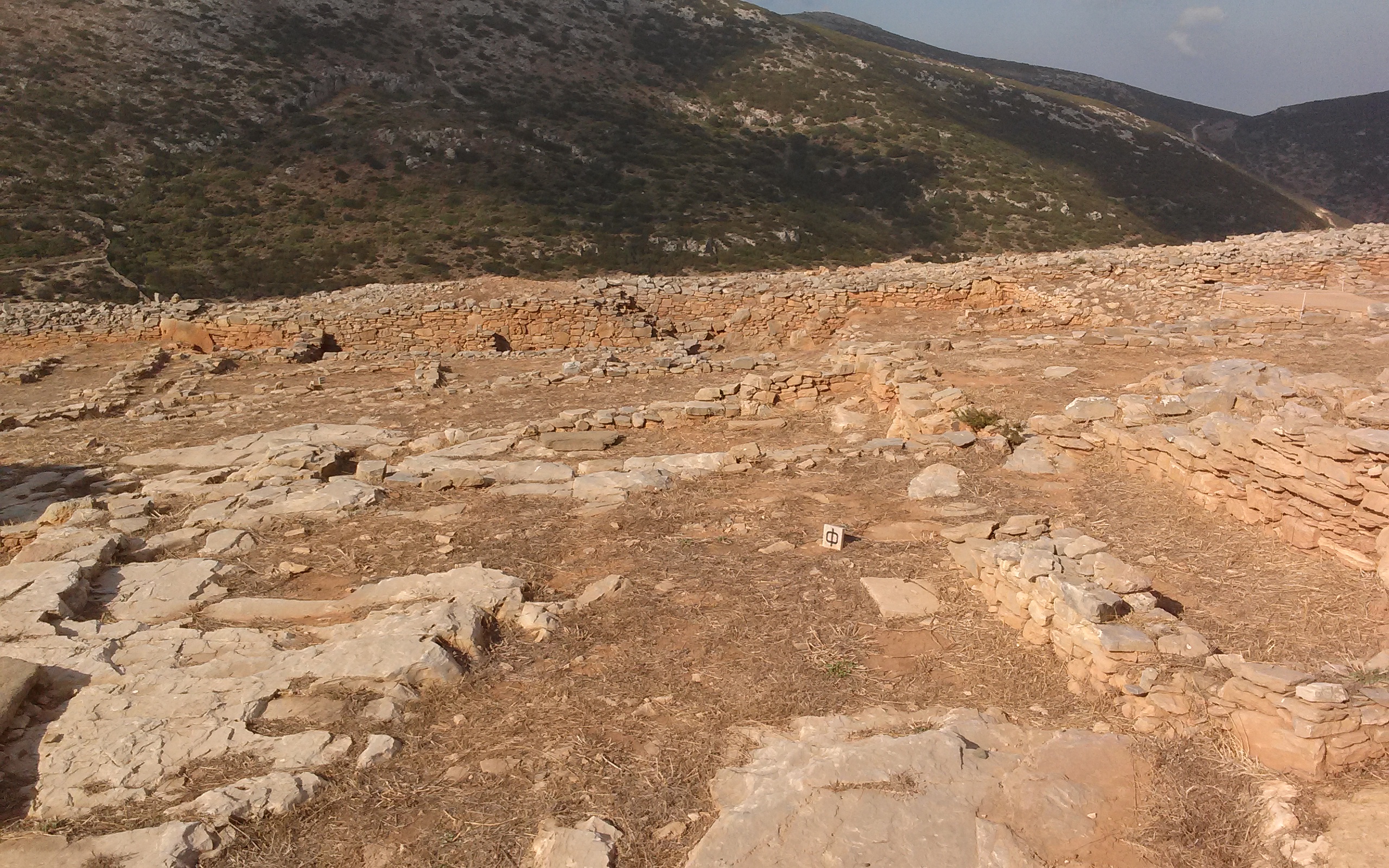
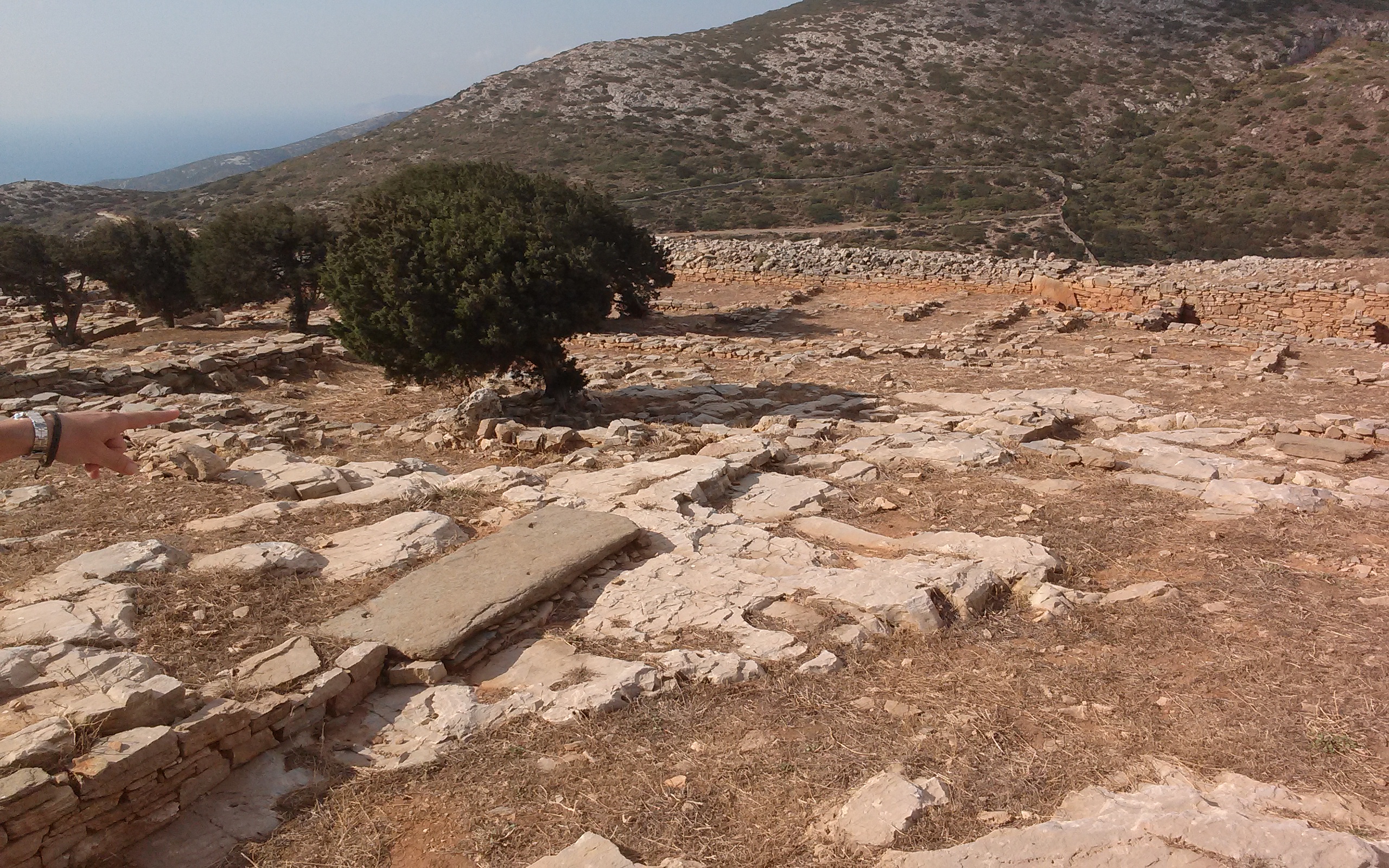
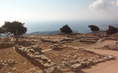
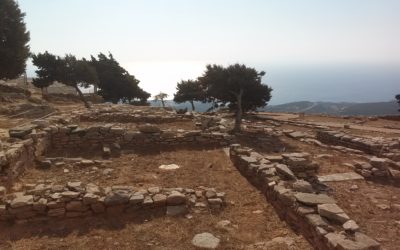
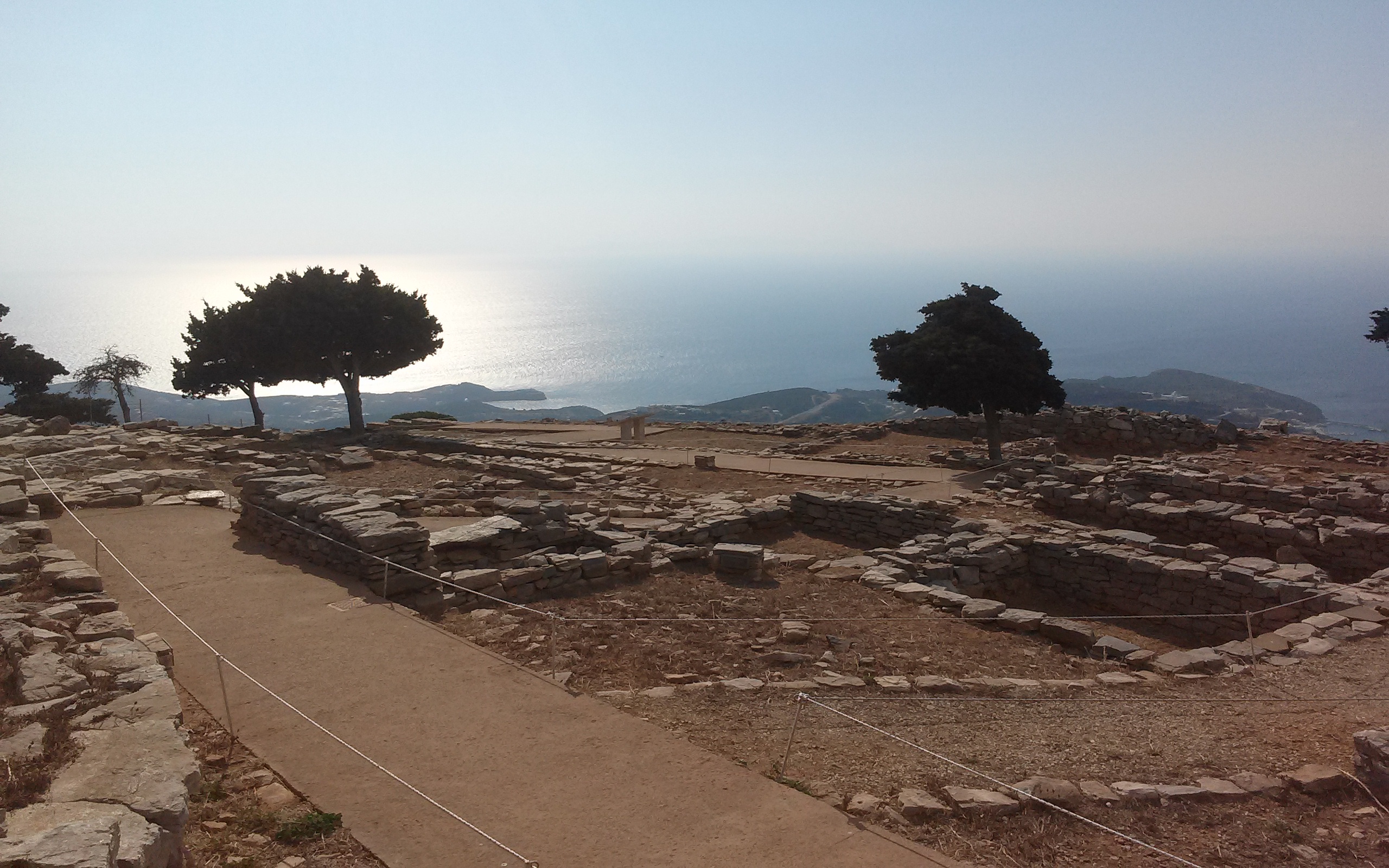
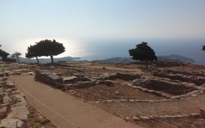
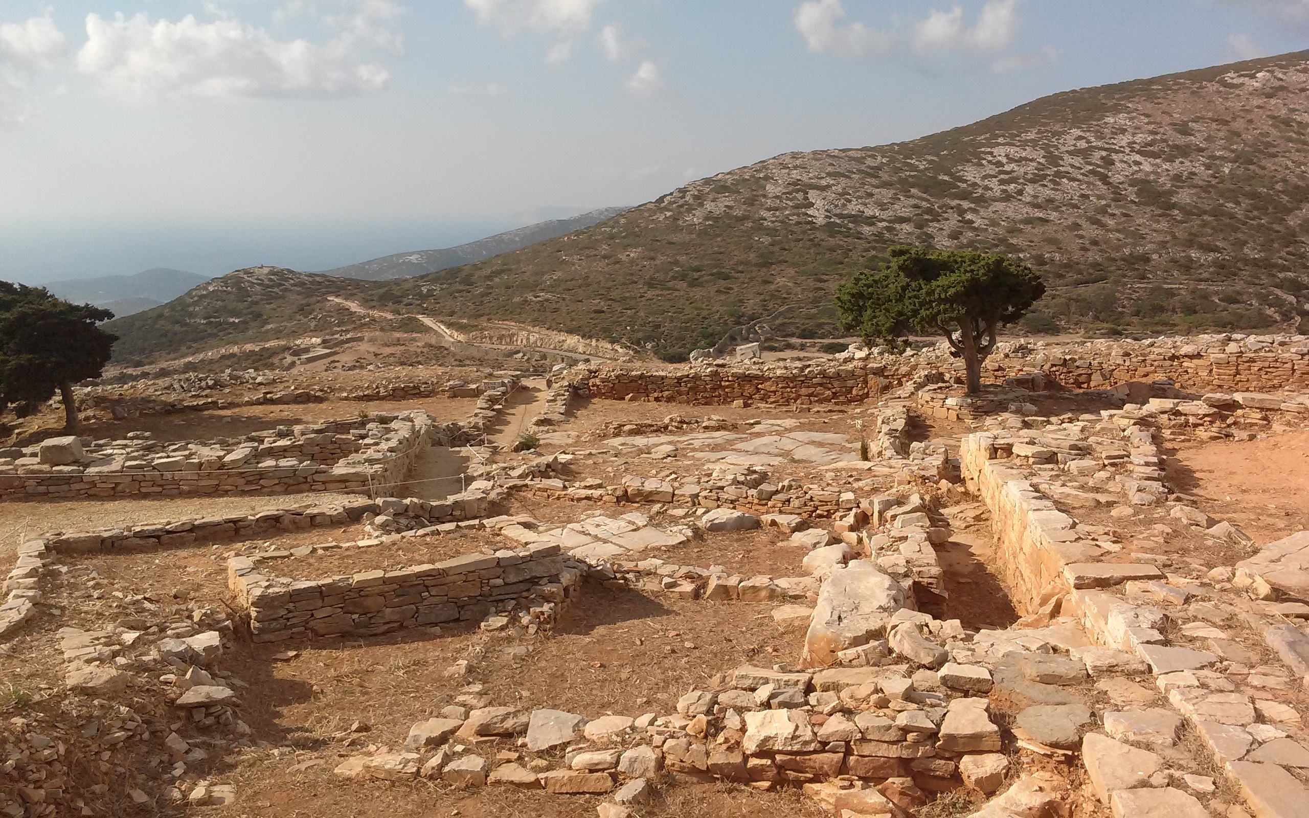
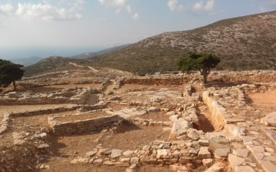
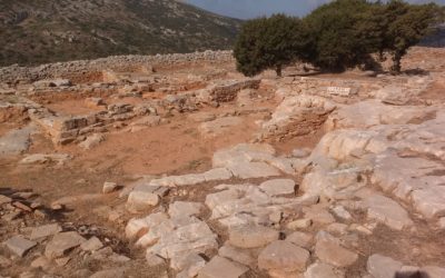
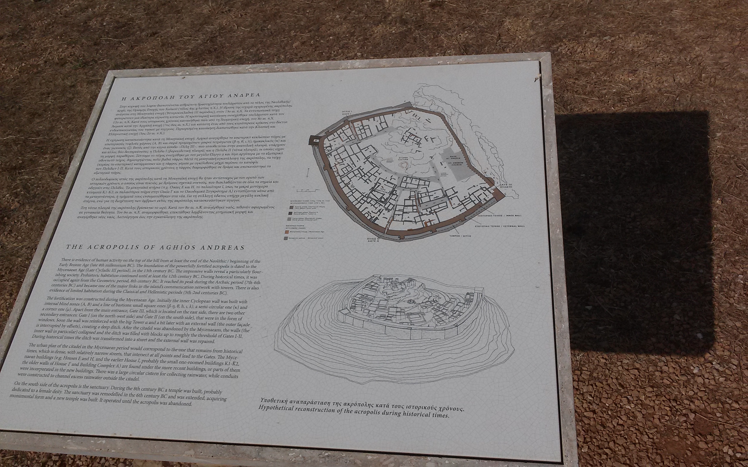
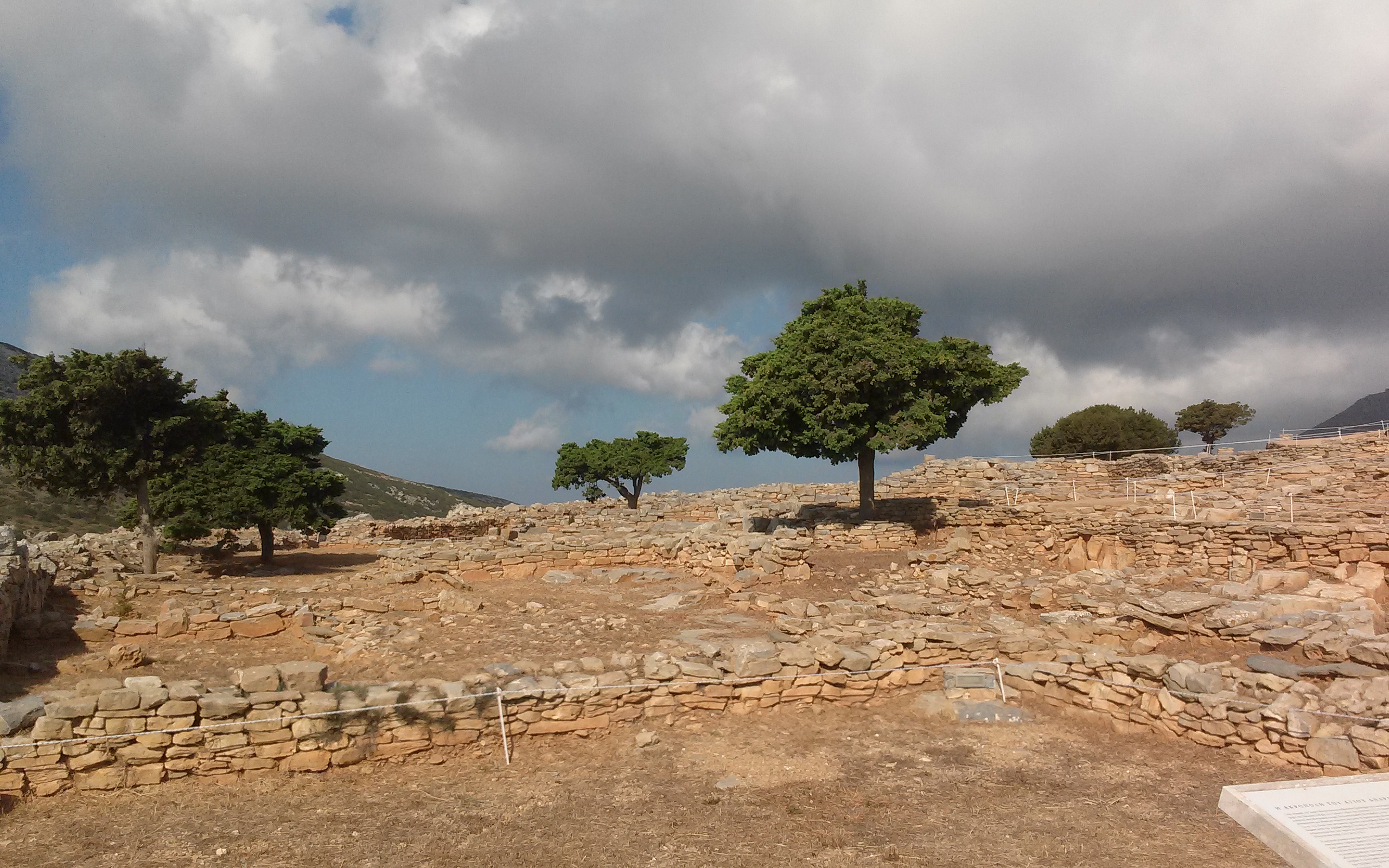
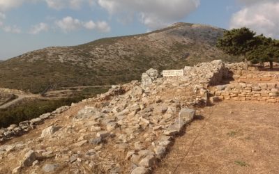
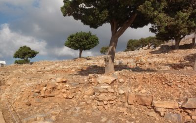
The acropolis of Agios Andreas (13th century)
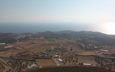
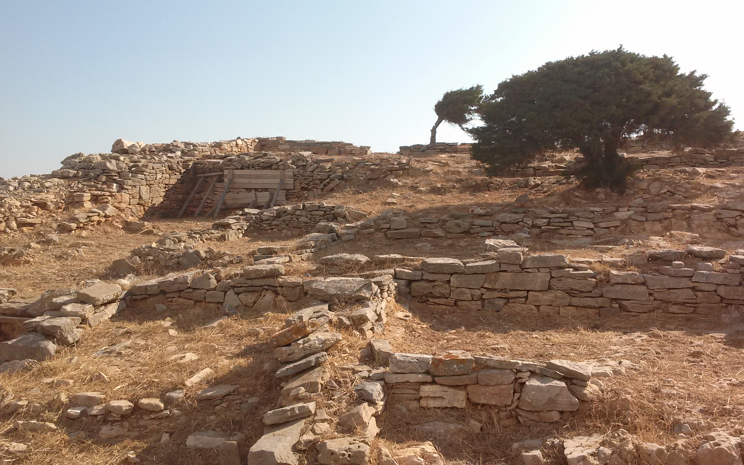
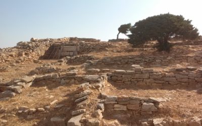
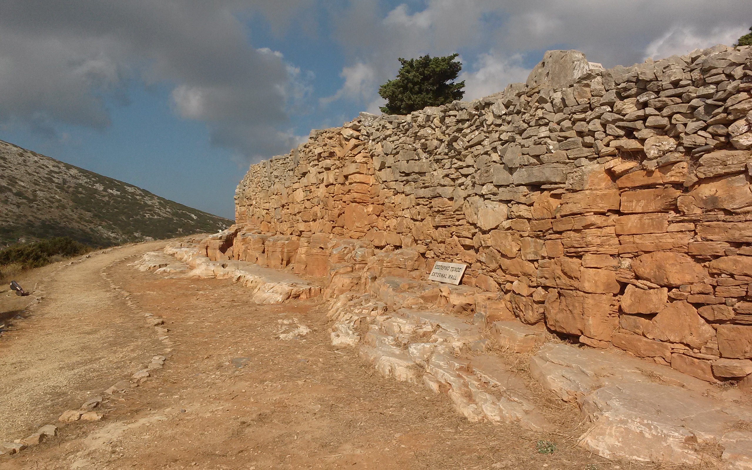
This is the first organised open-air archaeological site on the island that is open to the public. It lies on the plateau of the hill of Agios Andreas (Ai Dria as it is referred to by the local people) covering an area of about ten thousand square meters. The excavations in the region, both during the ten-year period from about 1970 to 1980 by the Sifnos archaeologist Varvara Philippaki, and the archaeologist Christina Televantou from 1997 to 2008 have revealed the monumental Mycenaean wall of the Acropolis and an intricate urban network that includes, together with the great temple, a variety of buildings, roads, rainwater water management works and a multitude of various categories of movable finds. The full revelation of this impressive Acropolis after so many thousands of years vividly brings to life the former glory and prosperity of the island.
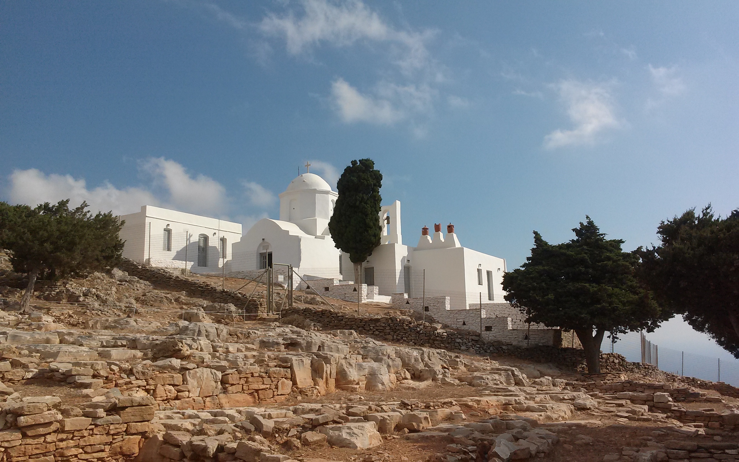

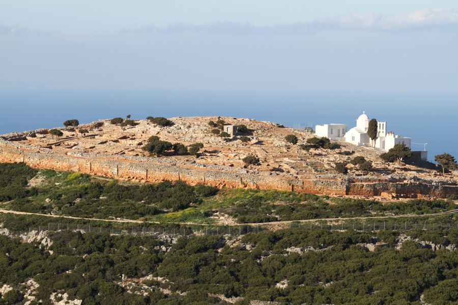

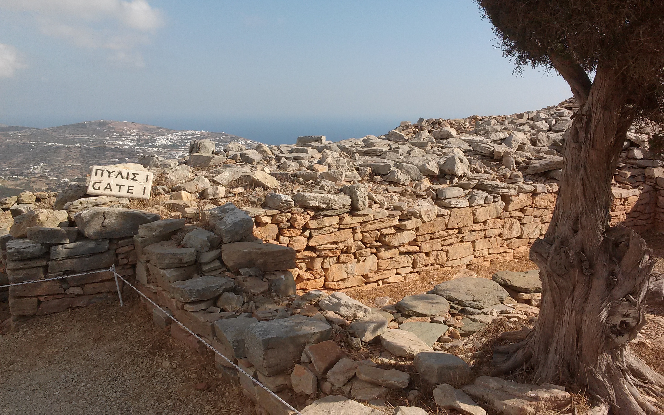


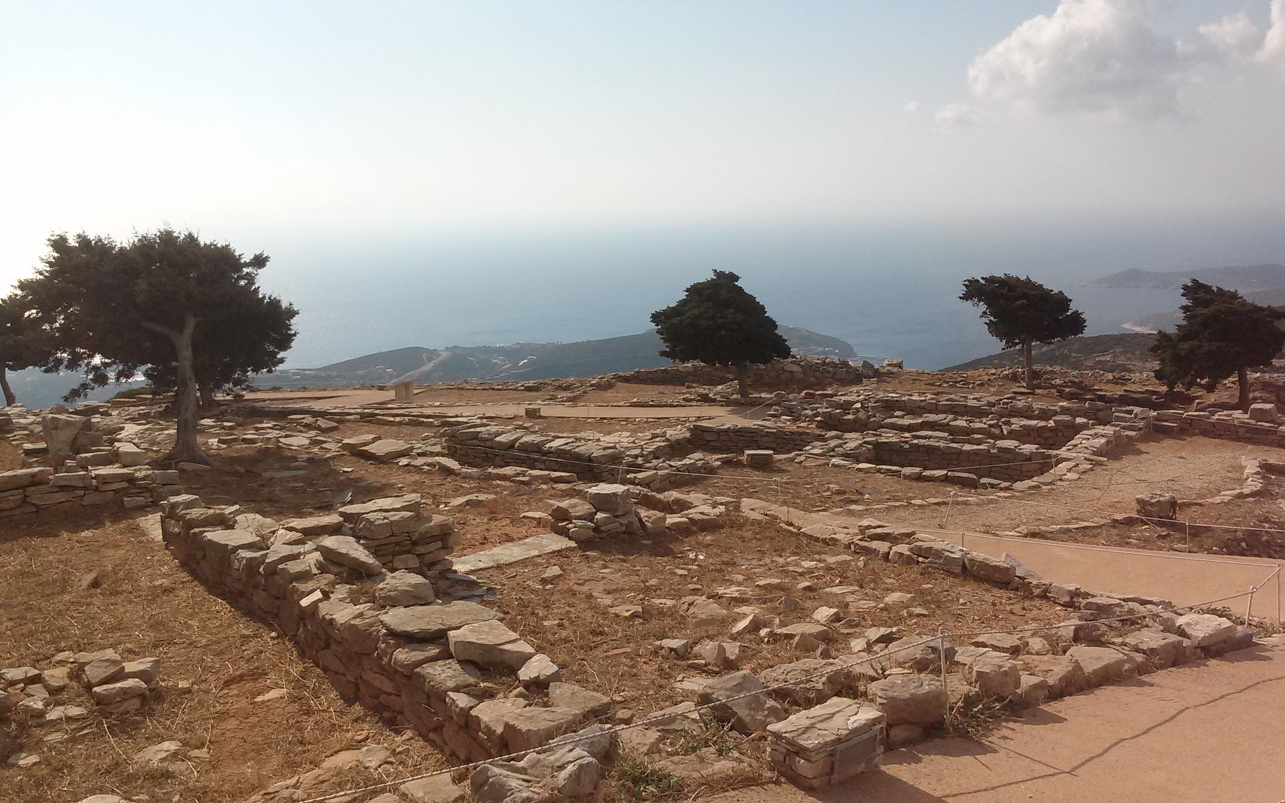


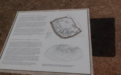


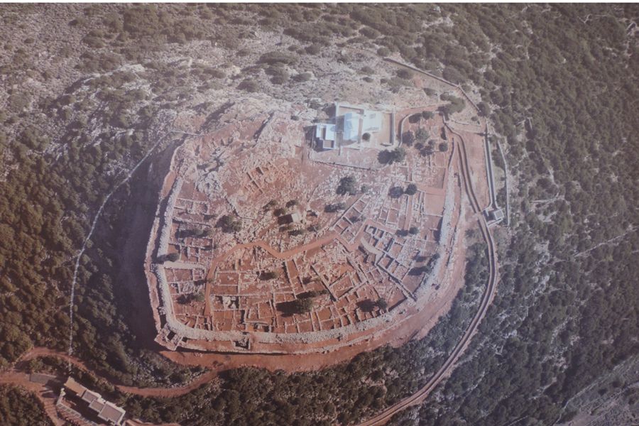

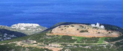
The site of the Acropolis and the exhibition building where the findings from the excavations of the area are on display is open to the public all year round, every day (except Mondays and public holidays) from 8:30 to 15:00
Other archaelogical sites
Ancient fort and temple on the hill of Agios Nikita (6th century BC)
From the Heronissos road, there is an uphill path leading to the hilltop of Agios Nikitas and the church of the same name. It is a walk of approximately 45 minutes. Parts of the walls of an ancient fortress and sanctuary, as well as the remains of an ancient tower, can be seen there next to the church.
The ancient temple on the hill of Profitis Elias of Troulaki(6th century BC)
A path leading uphill from the Heronissos main road is a 35 minute hike to the top of the hill of Profitis Elias (463 m), where there are the remains of the ancient temple.
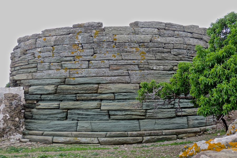
Ancient towers (6th – 3rd Century BC)
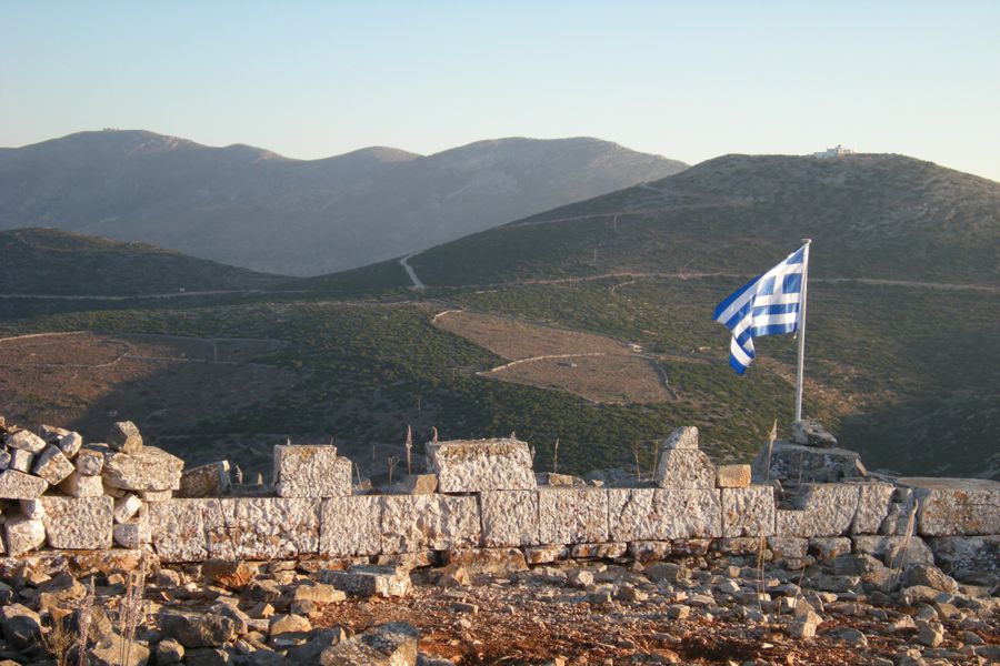
During the island prosperous period (during the 6th century BC), due to the wealth amassed from the exploitation of the mines, the Sifnians started building a network of beacon towers across the whole of the island. The first were close to the mines and they later extended the network to the rest of the island, in farming areas and other strategic locations (hilltops and hillsides). These fortified defensive structures were used both as lookout points and outposts to enable communication within and around the island, and as refuges for the rural population to retreat to when faced with surprise raids from pirates. All the towers on the island were round. They communicated with each other, and with the ancient acropolis citadels using mirrors and smoke signals. Today the archaeological service has recorded the details of 77 ancient towers on Sifnos, that is, more than one tower per square kilometre. Many of them are in remote locations and are more difficult to reach, but there are several that are more easily accessible.
Of those who survive to most of their full height and are more easily accessible, the most outstanding are the ‘Aspros Pyrgos’ (White Tower) at Pantocratora (6th century BC), the ‘Mavros Pyrgos’ (Black Tower) in Exambela (5th century BC) and the tower at Kade on the way to Vathi (4th century BC). Since 2003, almost two and a half thousand years after they were first put to use, local organisations and dozens of volunteers have revived the communication system of the ‘fryktories’, lighting the beacons once a year on Pentecost Sunday.
The sanctuary of the Nymphs in Korakies
The sanctuary can be found in Korakies, near Kamares (starting out at the Aqueduct, well below the ‘Mavri Spilia’ (the Black Cave), in the cliff side is an ancient inscription carved in the rock to the left of the entrance to the cave which says ‘NYFEON HIERON’ (Sanctuary of the Nymphs).
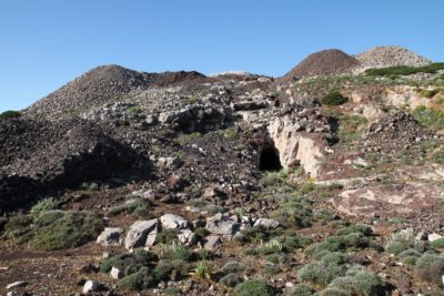
Ancient tomb of ‘Soroudi'(17th-11th century BC)
This large structure, probably a Mycenaean ‘tholos’ (dome-shaped) burial mound, is located at a site known locally as ‘Soroudi’ (near Pantokratora), clearly taken from the Greek word ‘soros’ (meaning ‘pile’ or ‘mound’). The construction is above ground, built on relatively flat land. Because of this, in order to retain the soil covering the mound in place, a cyclopean stepped terrace was built around the base. This is still visible despite the dense vegetation. On the west side, which is the steepest, there are ten terraces reaching a height of 5.50 metres. The maximum height of the mound and its terraced embankment reaches 20.45 meters. The roof of the tomb structure, which was probably looted in ancient times, has collapsed, together with sections of masonry from the vertical walls, and the remains can be seen scattered over the site. The Sifnian archaeologist, Iakovos Dragatsis, carried out small-scale excavations in the years 1915-1916, and found a few Roman sherds buried on the site. The ‘Soroudi’ is an impressive monument, visible from many parts of the region, with a direct line of sight to the Mycenaean acropolis on the Agios Andreas hilltop. It is not unlikely that it is the burial mound of a Mycenaean lord who was in some way connected to the sea, and that this why this vantage point, overlooking the entrance to the bay of Platy Gialos, was selected.

